My name is Brandon Silverman. I’m a dad, former start-up founder and these days, a transparency activist (you can read more about some of my story here). But I’m also a designer. And like most designers, I’ve spent a lot of time over the last 15 years reading kottke.org. This project is the culmination of several years work that all started when I read a post on kottke over 10 years ago.
On September of 2011, I saw this post on kottke.org. It was a link to a blog called BibliOdyssey where there was a small collection of incredible typography from something called the Sanborn Fire Insurance Maps. I had never seen them before and they blew my mind.
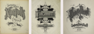
I was totally blown away by the titles and must have revisited the BibliOdyssey blog a dozen times over the next several weeks. I also began building out my own personal collection of the best titles by visiting various digital archives of the maps, including ones at the Library of Congress, various university libraries around the country and more.
A few months later, my fiancee and I actually decided to model our wedding invitation off of the titles and I got to work drawing our own customized Sanborn-inspired wedding invitation that went something like this:
The drawing still hangs in our house today.
But throughout all of this, I also learned something in the process of making our wedding invitation…namely that there was no particularly good place to go if you wanted to see all the amazing art from the Sanborn maps. The BibliOdyssey post was literally one of the best collections online and it only had about 30 of them.
So, about a year ago, I began trying to collect and organize all of the titles.
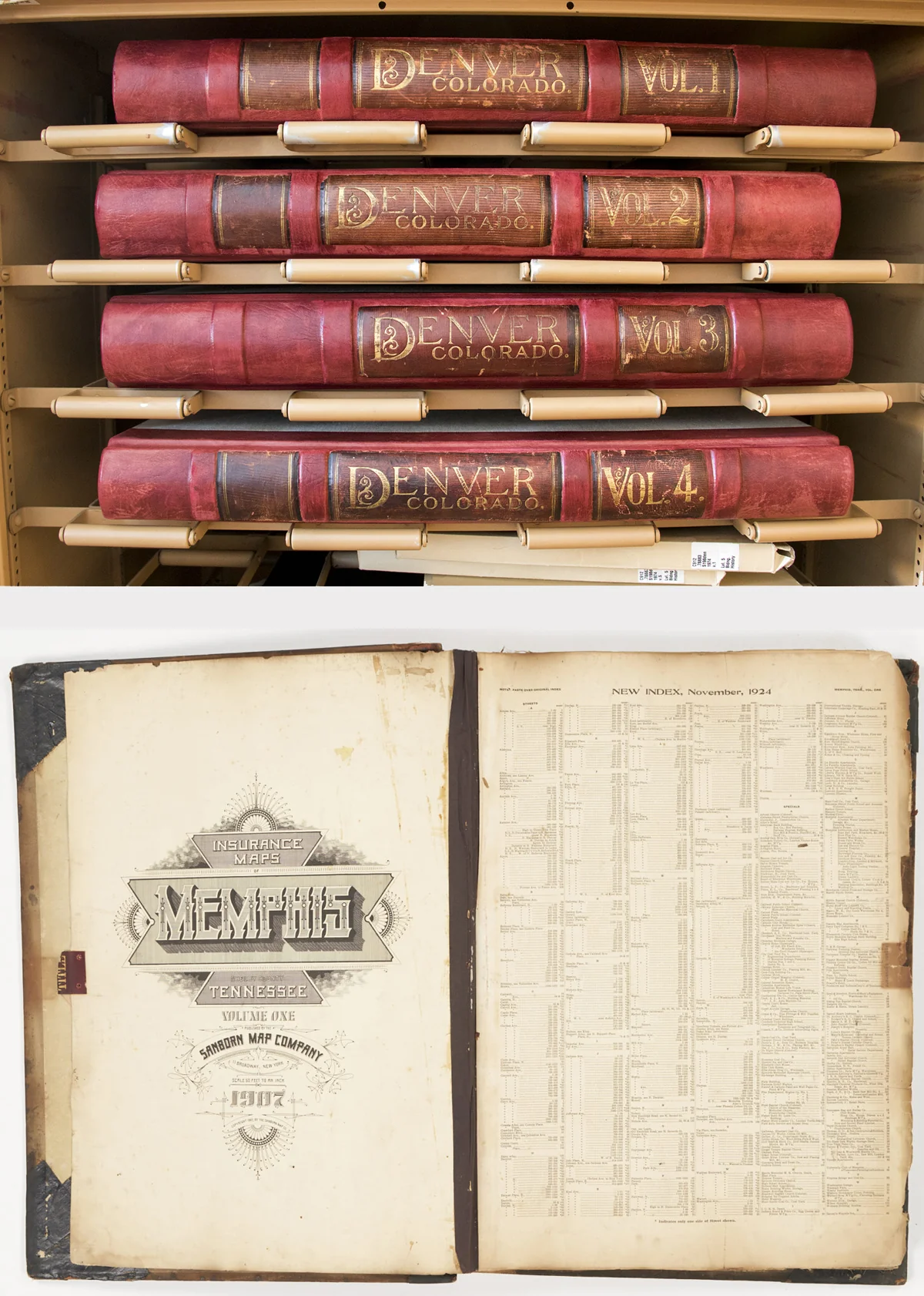
The good news was that majority of the maps have actually been digitized and a large percentage is available online at the Library of Congress; however, it’s not easy to find the title pages. There are also a lot of maps that weren’t at the Library of Congress and isntead sit in various university libraries around the country…some of which are well organized and some of which aren’t. But after about a year, I’ve managed to collect almost all of them and that’s what this website is dedicated to.
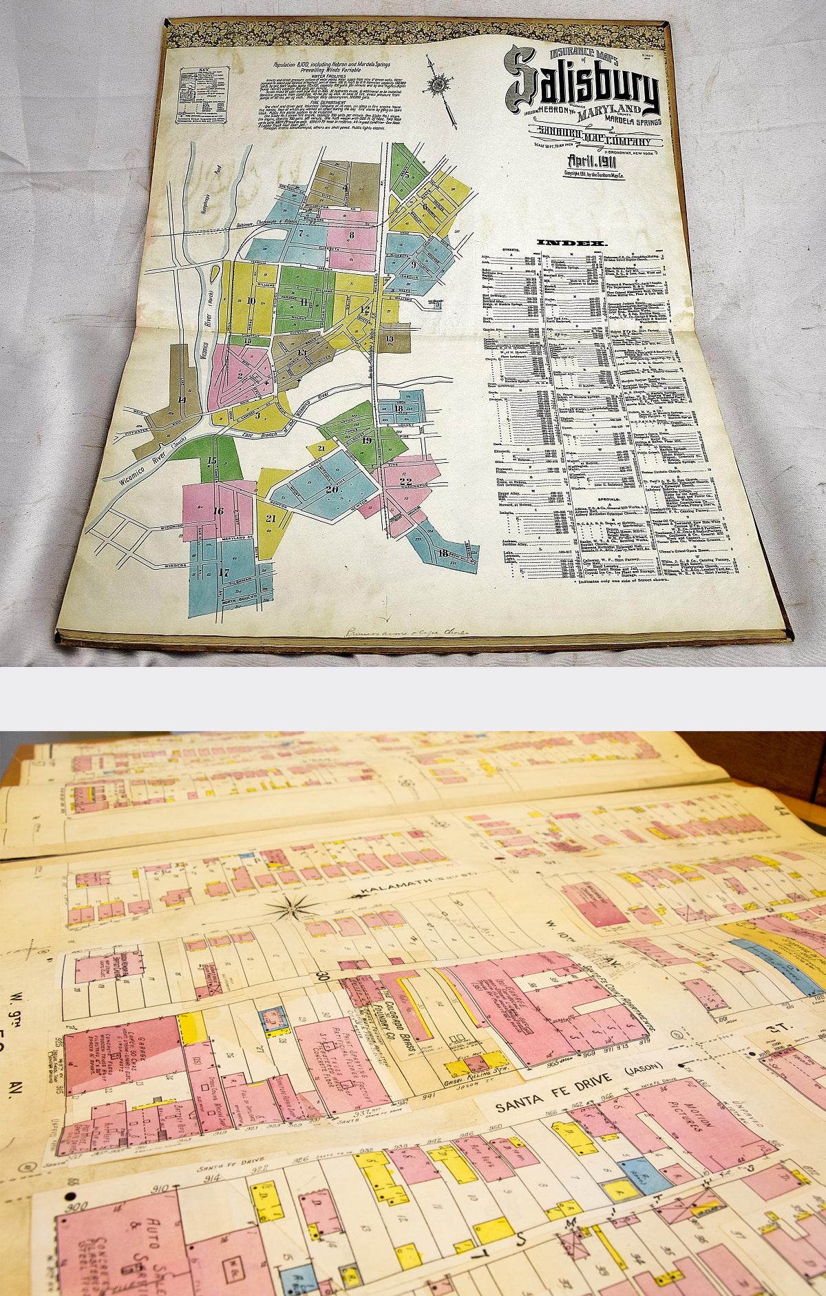
It’s an archive of over 3,500 individual images, all published before 1923, of almost all the art found within the Sanborn maps.
The archive is completely free and available in the highest resolution formats that I could find from each of the online libraries. I’ve also picked out some of my favorite titles, which you can see here. However, in addition to the archive, I’ve also added some e-commerce to help cover some of the cost of the archive. I’m going to keep adding more products over time but for now, I’ve broken it down into a fairly random collection of products across some major metropolitan areas.
This is purely a passion project and if you have any feedback or advice or thoughts, I’d love to hear them!
The Sanborn Maps are a very cool phenomenon of history.
They represent the most detailed collection of urban history that exists in America and they are regularly used by historians, urban designers, anthropologists and more. If you go to your local library, chances are there will be a collection of original Sanborn maps that you can check out.
The Sanborn fire insurance maps (wikipedia) were created by Daniel Alfred Sanborn, a civil engineer and surveyor. In 1866, he was contracted by the Aetna Insurance Company to prepare maps of areas in Tennessee. About the same time, he developed similar maps of Boston, published as Insurance Map of Boston, Volume 1, 1867. Seeing a lucrative market for this type of map, he established the D. A. Sanborn National Insurance Diagram Bureau in New York City to publish the Boston atlas and develop and sell maps of additional areas. Within several decades, the company became the largest and most successful American map company.
Sanborn maps were designed to help insurance companies assess the fire risk of individual properties. They were highly detailed, showing the size, shape, and construction of buildings, as well as the materials used in their construction. This information was used by insurance companies to calculate the premium that a property owner would have to pay for fire insurance.
The Sanborn map company flourished in the late 19th and early 20th centuries. As cities grew and became more densely populated, the need for accurate fire insurance maps became even more important. Sanborn maps were used by insurance companies all over the United States, and the company had offices in major cities across the country. The use of Sanborn maps began to decline in the 1960s. As building codes became more stringent, and as fire suppression technology improved, the need for such detailed maps became less important. The Sanborn map company continued to publish maps until 1977, but the company filed for bankruptcy in 1980. The rights to the Sanborn maps were acquired by a number of different companies over the years, and they are now available for purchase online and in libraries.
Although Sanborn maps are no longer used by insurance companies, they remain a valuable resource for historians, urban planners, and anyone interested in the history of American cities. They provide a detailed record of how cities have changed over time, and they can be used to study the development of architecture, transportation, and infrastructure. In addition to their historical value, Sanborn maps can also be used for a variety of practical purposes.
For more history on the maps, you can check out these resources:
- Short YouTube documentary on the history of the maps
- Detailed history of the maps from the Library of Congress
- Bloomberg’s CityLab: The Accidental Revelations of the Sanborn Maps
This collection is a passion project that started over 10 years ago.